Suntoucher - Sunlight Simulator
When you're considering a property — whether to buy, rent, build on, or list — sunlight is one of the variables that's hardest to evaluate from a listing photo. A south-facing balcony in summer is not the same balcony in February. A garden that catches morning sun in May sits in shadow for half the day in October. Suntoucher is a free tool we built to make these patterns visible: enter any address, and the interface shows where the sun falls on that property at any hour, on any date of the year.
The tool is available at suntoucher.braunsberger-media.com and works without registration.
Who it's for
Suntoucher started as an internal experiment but quickly proved useful across several scenarios that share a single problem: making decisions about a place before you can stand in it.
For property buyers and renters, the most common question is whether the living room, terrace, or garden actually gets the light the listing implies. Pulling up the address and scrubbing through the day answers that question in seconds — including for properties in cities you haven't visited yet.
Architects and designers use it for early-stage orientation studies. Knowing how shadows from neighboring buildings fall across a site at different times of day shapes decisions about window placement, outdoor areas, and passive solar gain. It doesn't replace a full daylight analysis, but it's a fast way to develop intuition before committing to detailed modeling.
Real estate agents and short-term rental hosts use it to prepare viewings and listings — booking the showing for the hour the property looks its best, or photographing the terrace when the light is on it rather than off it. Garden planners and solar installers have also found uses we didn't anticipate.
How it works
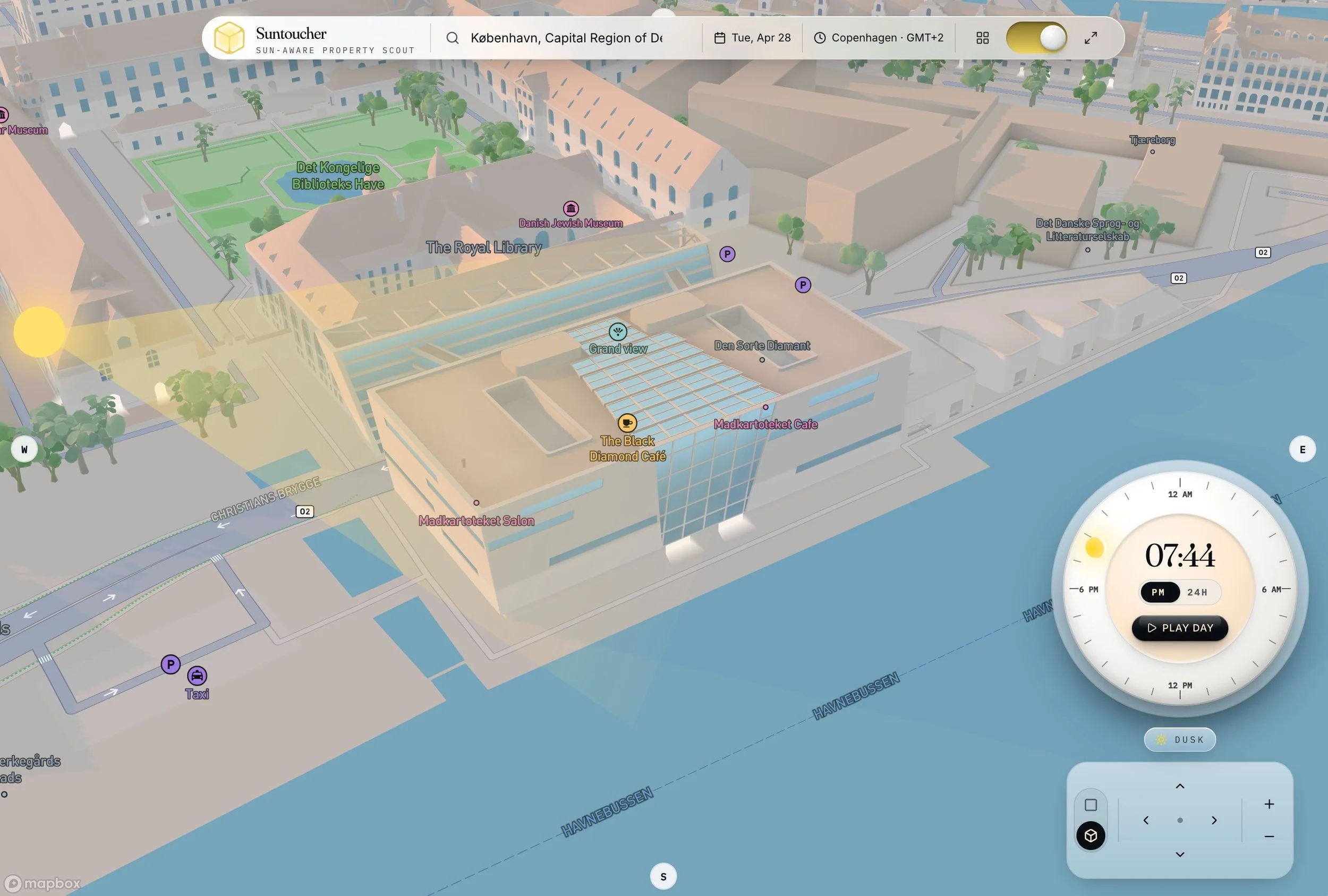
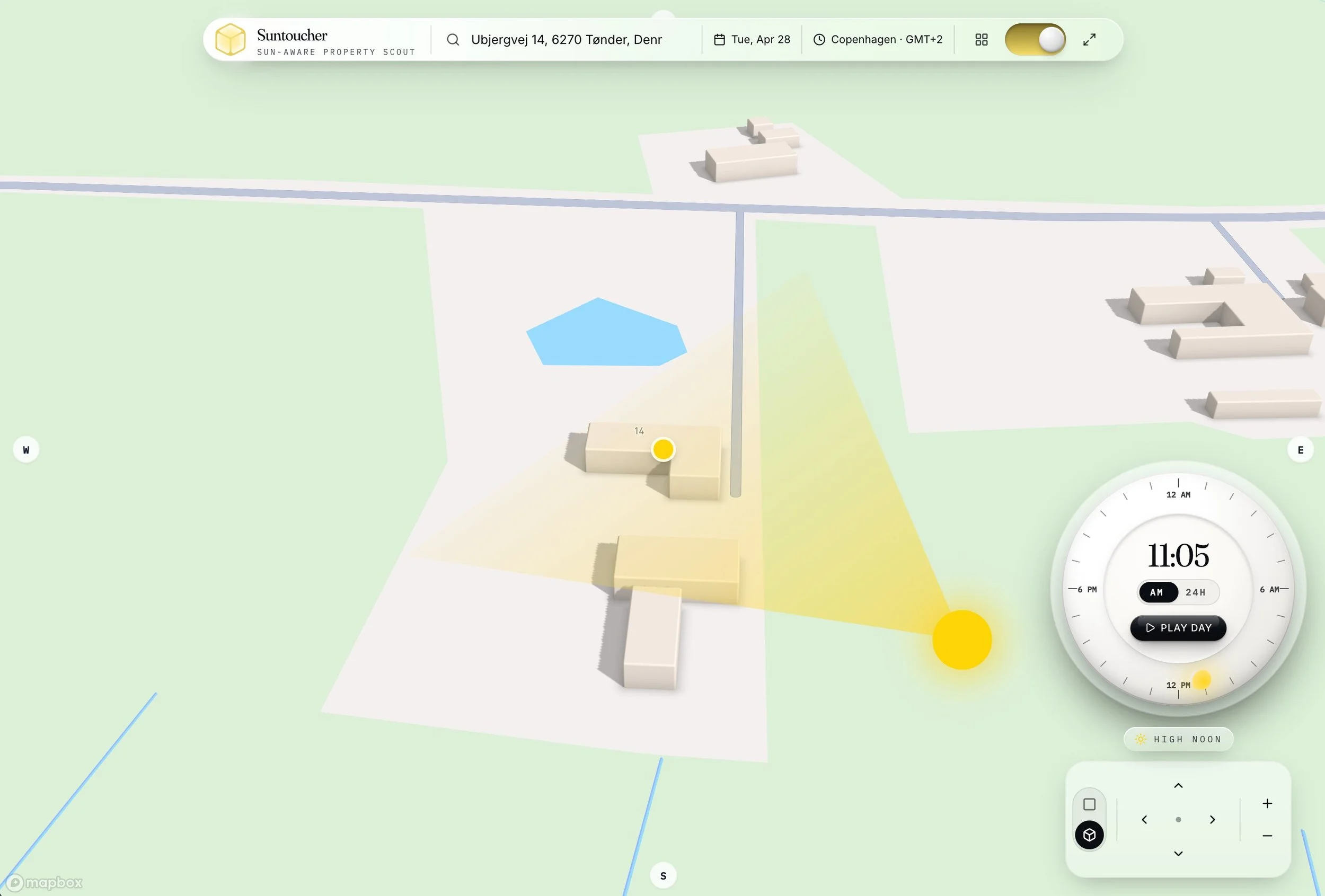
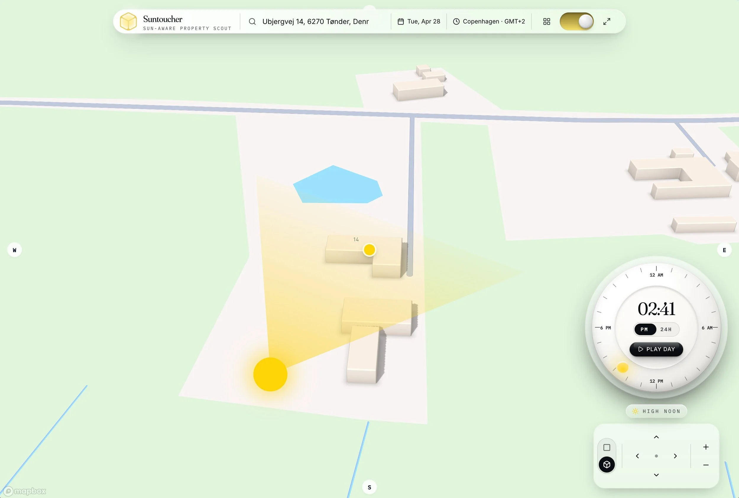
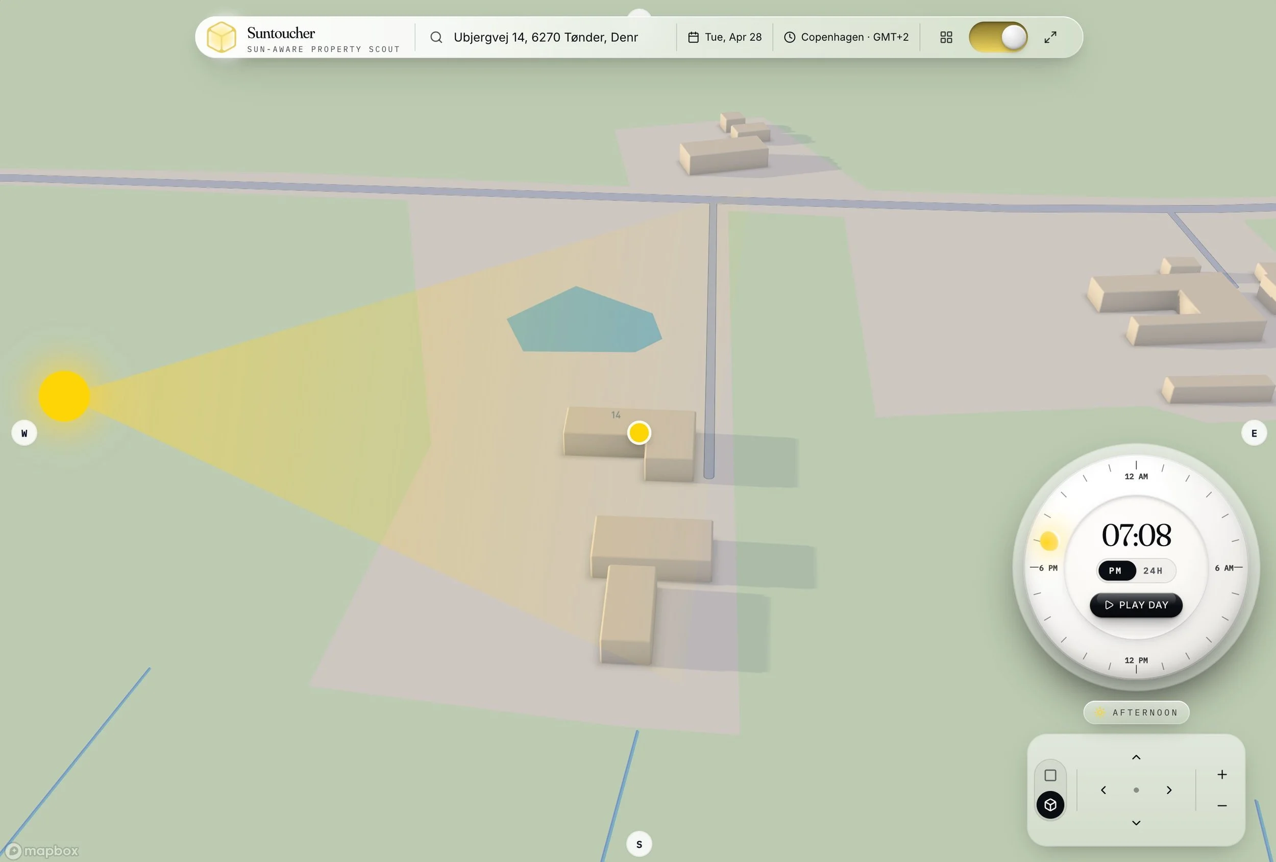
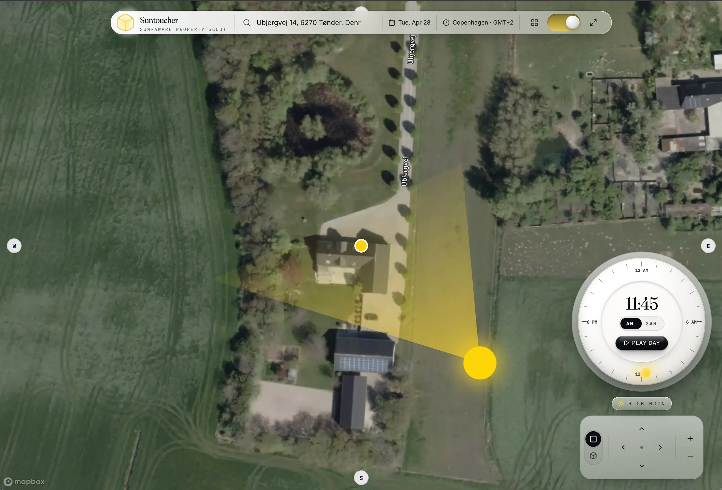
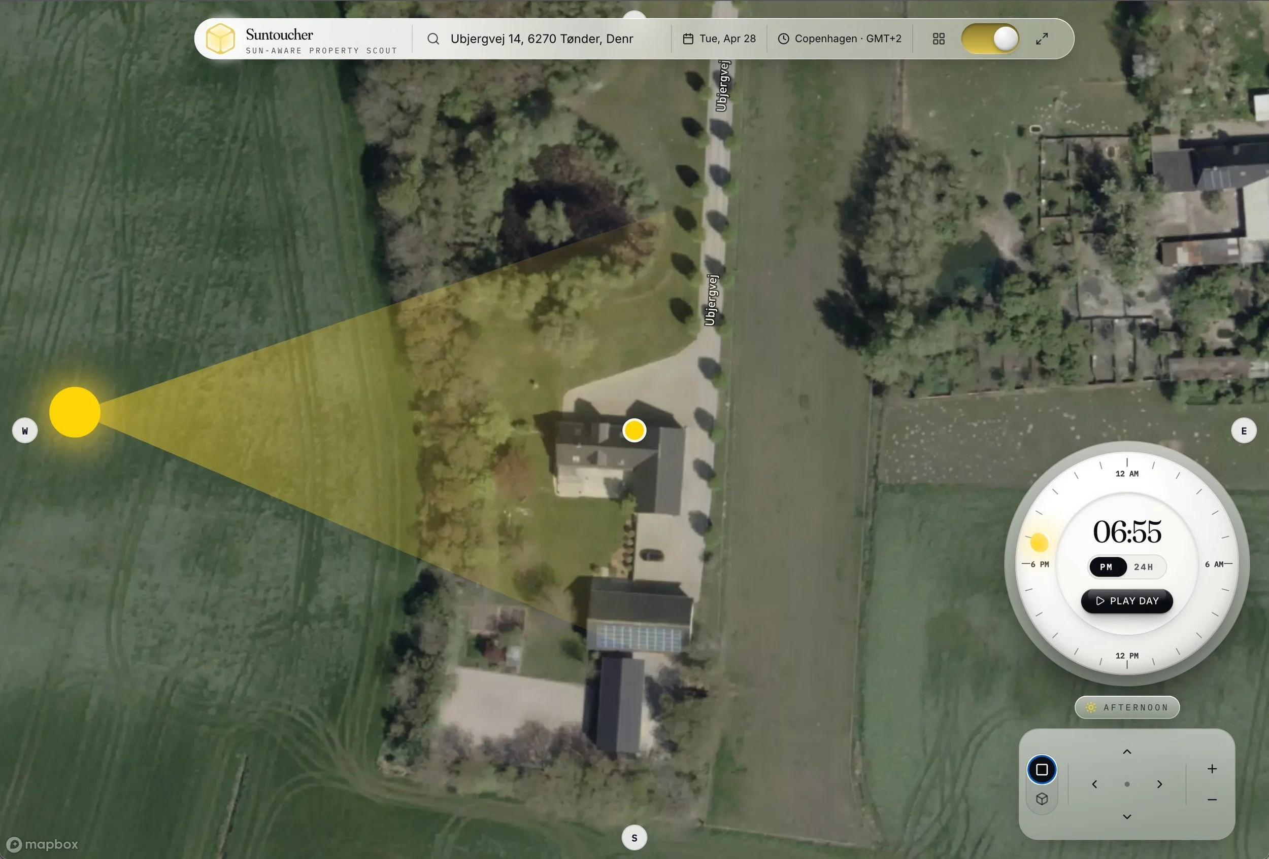
The core interaction is a time dial paired with a map. Drag the dial to move the sun across the day, and the map updates the sun's position and the corresponding light cone in real time. Press Play Day and the sun traces its full arc from sunrise through high noon, afternoon, dusk, and night — a complete daily cycle compressed into a few seconds.
Three features do most of the work behind that experience:
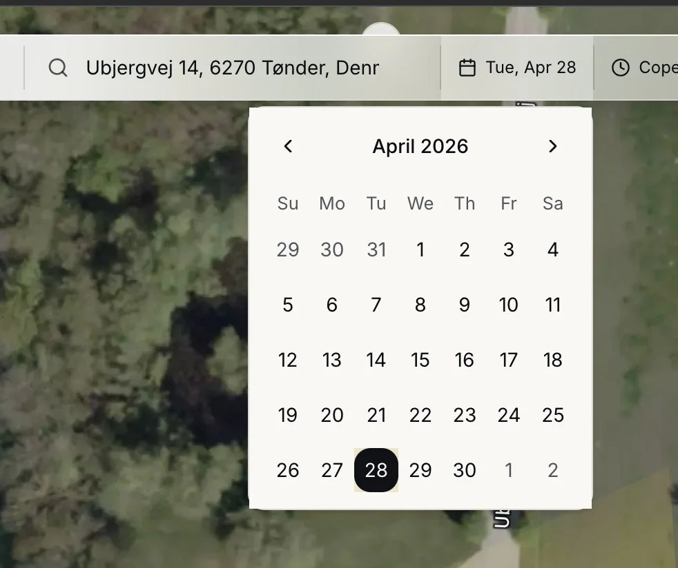
The date picker lets you pick any day of the year. The sun's path in late June is dramatically different from its path in late December, especially at higher latitudes — Copenhagen at midwinter sees the sun barely clear the horizon. Switching the date lets you check whether the apartment that looks bright in your summer viewing will still see direct light in January.
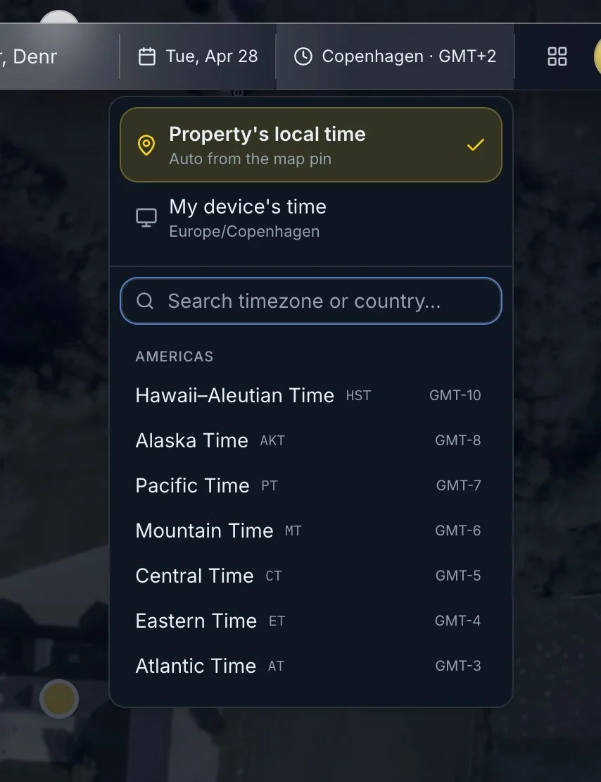
The timezone control handles a subtle problem that catches a lot of similar tools: when you look up a property in another country, what does "07:45" mean? Suntoucher defaults to the property's local time, automatically derived from the map pin, so the dial reads in the same hours someone living there would experience. A manual override is available when you want to align with your own timezone instead. (Timezone handling is still marked beta — edge cases around DST transitions are the main thing we're refining.)
The 3D map view is where the tool earns its name. Buildings, terrain, and surrounding context are rendered as three-dimensional geometry, so the light cone doesn't just show where the sun is in the sky — it shows where the sun actually reaches the ground after being blocked by everything in front of it. A property hemmed in by tall buildings to the south will show its real exposure, not the theoretical exposure a flat 2D model would suggest. A toggle switches between this stylized 3D view and a satellite view for users who prefer to work from aerial imagery.
The technology behind it
Suntoucher is built on Mapbox's 3D map APIs, which provide the building geometry, terrain data, and rendering pipeline that make the shadow visualization possible. Mapbox's recent improvements to global 3D coverage are part of what made a project like this practical — a few years ago, the building data simply wasn't there for most of the world outside major metropolitan areas.
The application itself was built on Lovable, the AI-powered full-stack platform we use as our primary environment for web application development. Braunsberger Media is a Diamond-tier Lovable partner, and Suntoucher reflects the kind of project the platform is well-suited to: a focused, interactive tool with a custom interface, real-time data, and a clear single purpose. We use the same workflow for client builds ranging from internal admin panels to public-facing SaaS products.
For anyone curious about what's possible to build on Lovable beyond the typical landing-page demos, Suntoucher is a reasonable reference point. It's a production tool with real users, not a prototype.
Limitations worth knowing
Suntoucher models geometric sun position and direct shadow casting. It does not account for atmospheric conditions, cloud cover, reflected light, or seasonal changes in tree canopy density. The 3D building data is only as good as Mapbox's coverage in a given area — strong in major cities, less detailed in rural regions. For most property decisions, geometric accuracy is enough to answer the question that matters: when does the sun reach this place, and when does it leave?
Try it
Suntoucher is free at suntoucher.braunsberger-media.com. We keep developing it as the underlying mapping and rendering technology improves, and feedback is welcome.